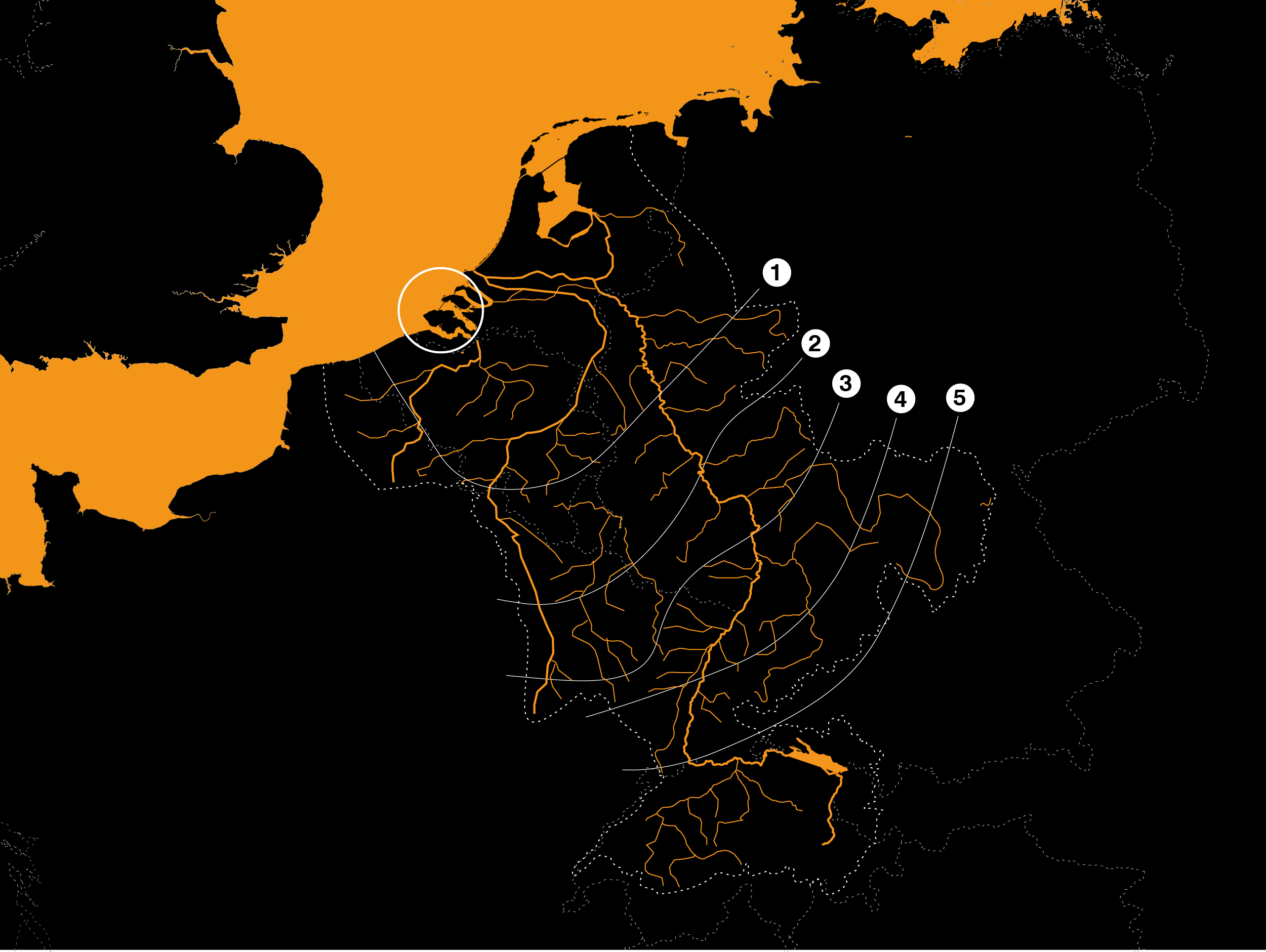
Zeelandia is taking advantage of sea level rise to investigate the spatial potential of the Southwestern Delta. The estuary of dutch rivers is considered a spatial laboratory. Here is a defined and characterful landscape in which waterworks, food production, energy production, nature and habitation reinforce each other. Zeelandia is a provocative laboratory for the spatial development of the Netherlands. The study was set up in the context of Redesigning Deltas (RDD), a collaboration between TU Delft, Deltares, WUR and PBL.
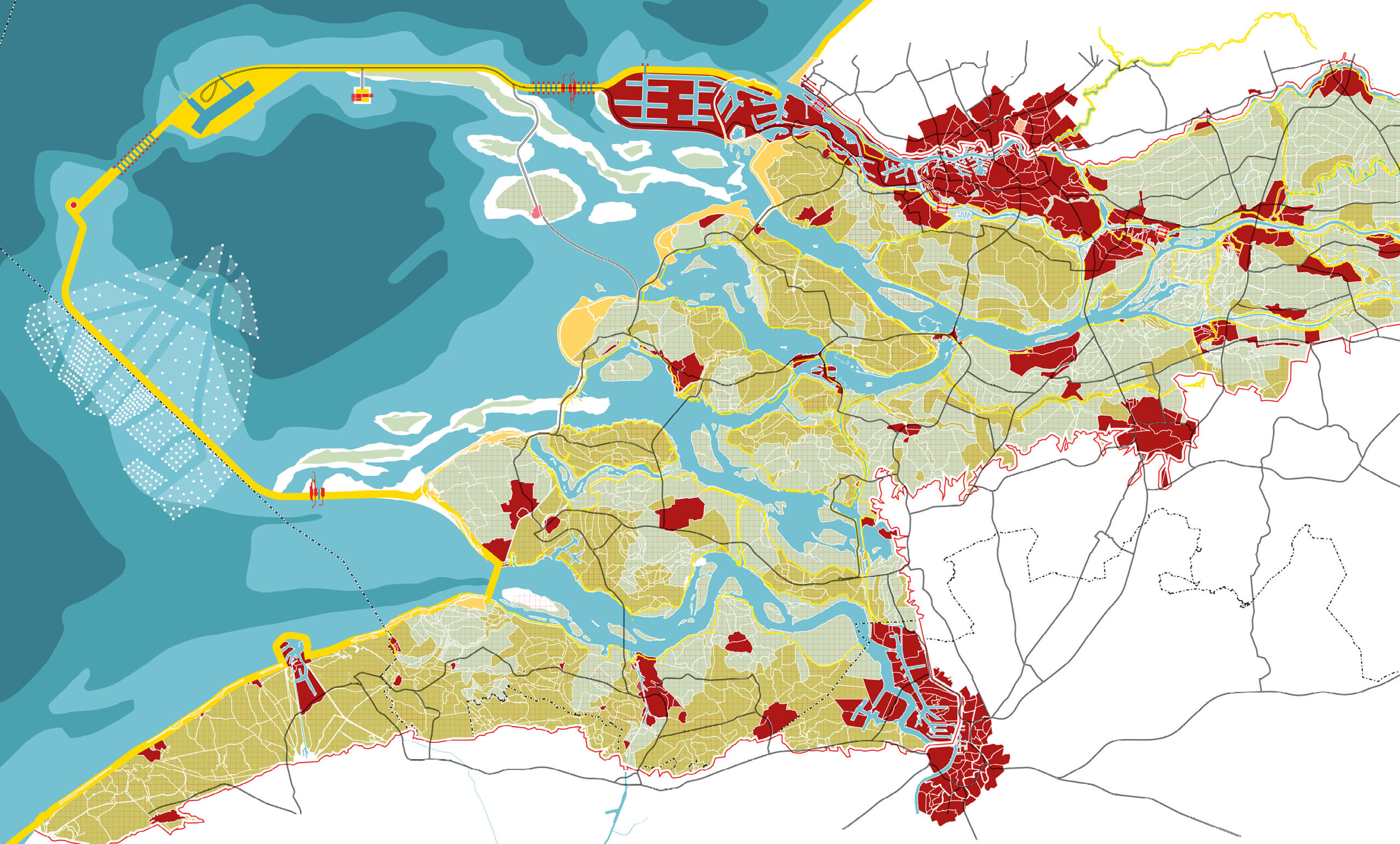
Where in the Dutch tradition the land has become a commodity, in the Southwest delta the land reclaimed from the sea and man-made is filled with pride. Systematic choices have been made here in the past that have resulted in a landscape that shows itself more powerful and resilient every decade. The interplay of dikes, dams, windmills, vast fields and the ever-present threat of the raging sea form an impressive interplay here. Sea level rise puts this landscape under pressure, but also offers opportunities to reshape the landscape. Zeelandia as a green-blue Arcadia, flanked by Rotterdam and Antwerp as the head on the new habitationbanana on the higher grounds of the Netherlands.
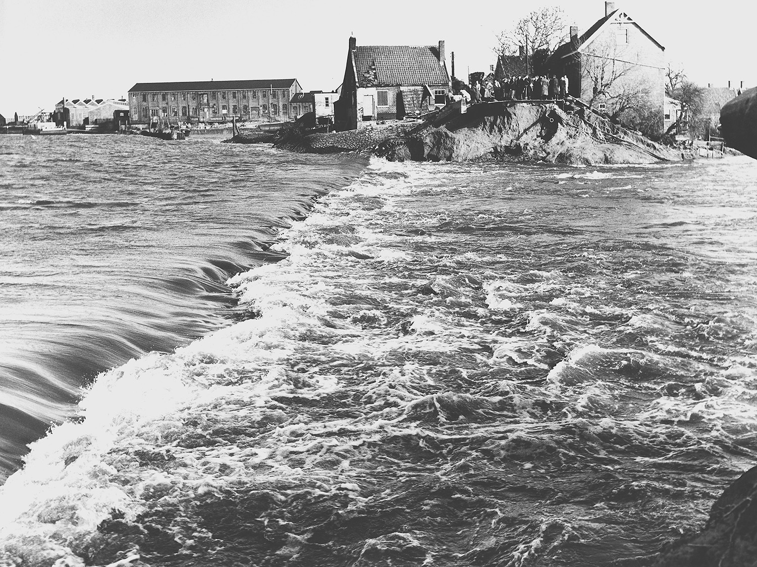
Climate change, global warming and related sea level rise are as topical as they are elusive. This study assumed a hypothetical sea level rise of 3 meters, without the (in)probability of this being known. It is a change with a huge impact and therefore relevant to be able to recognize a gradual change as a fundamental reversal.
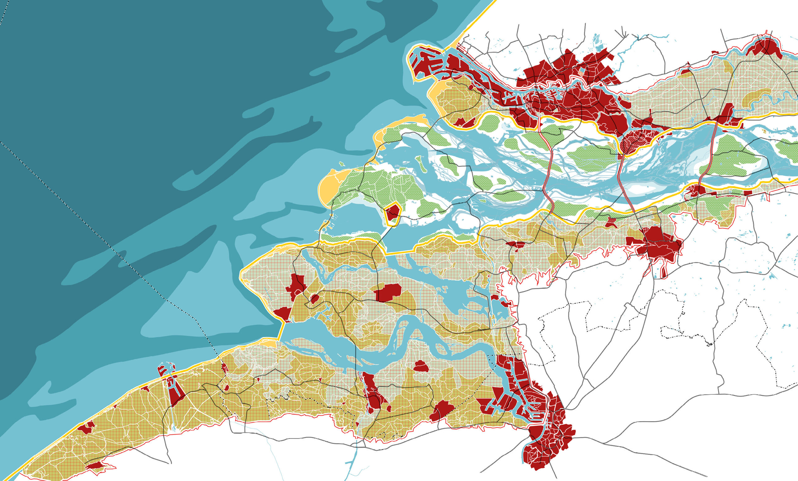
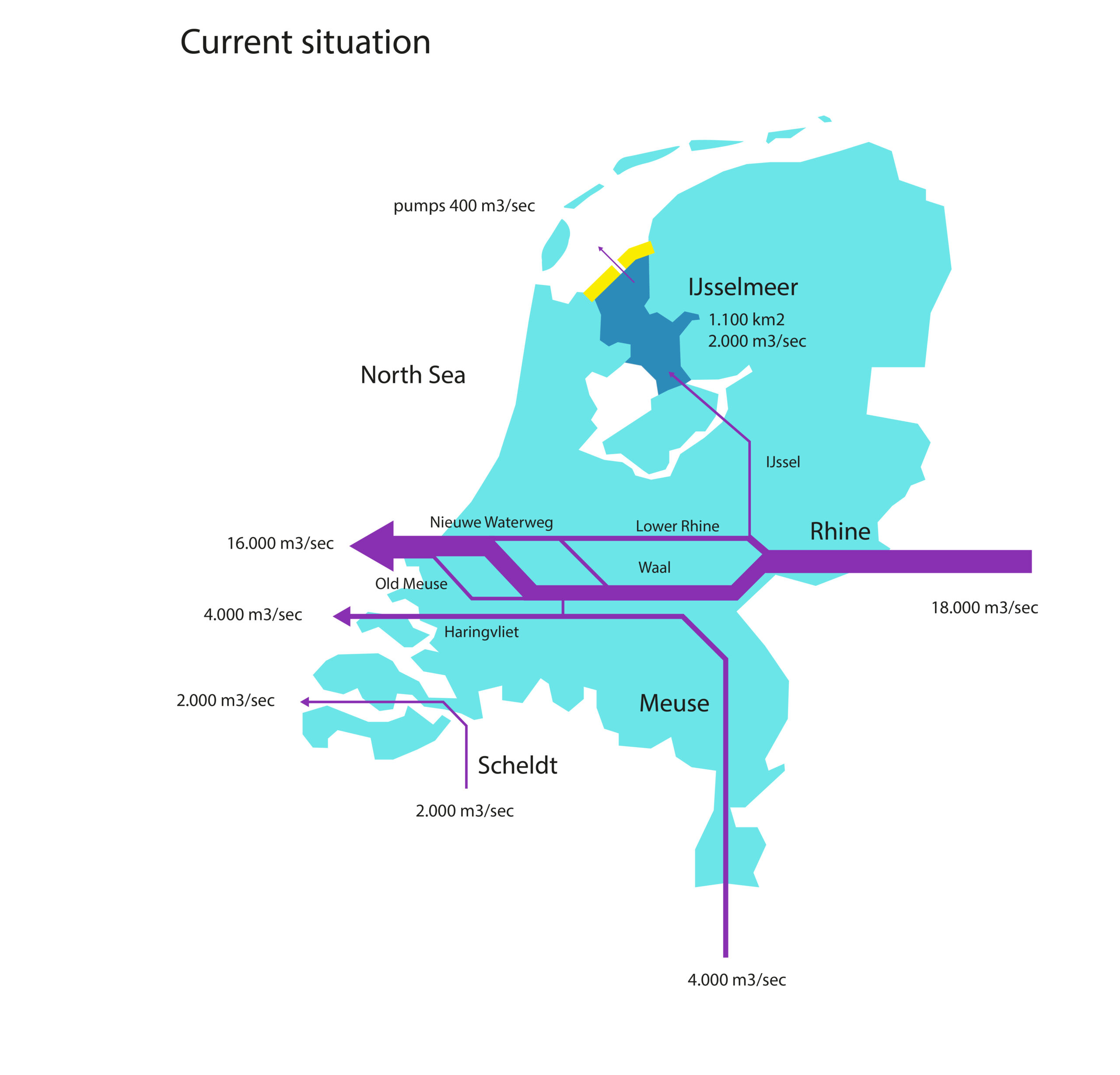
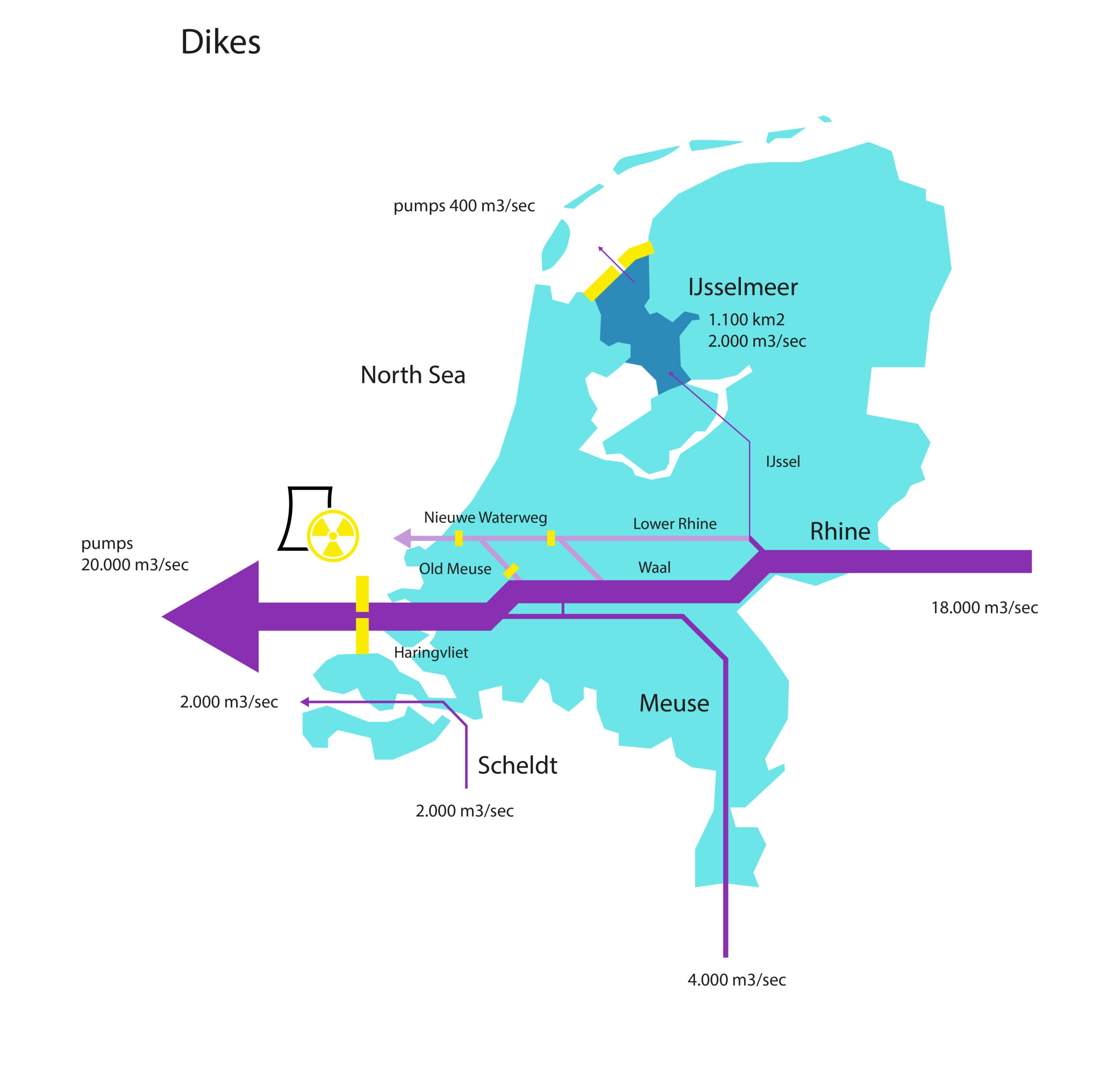
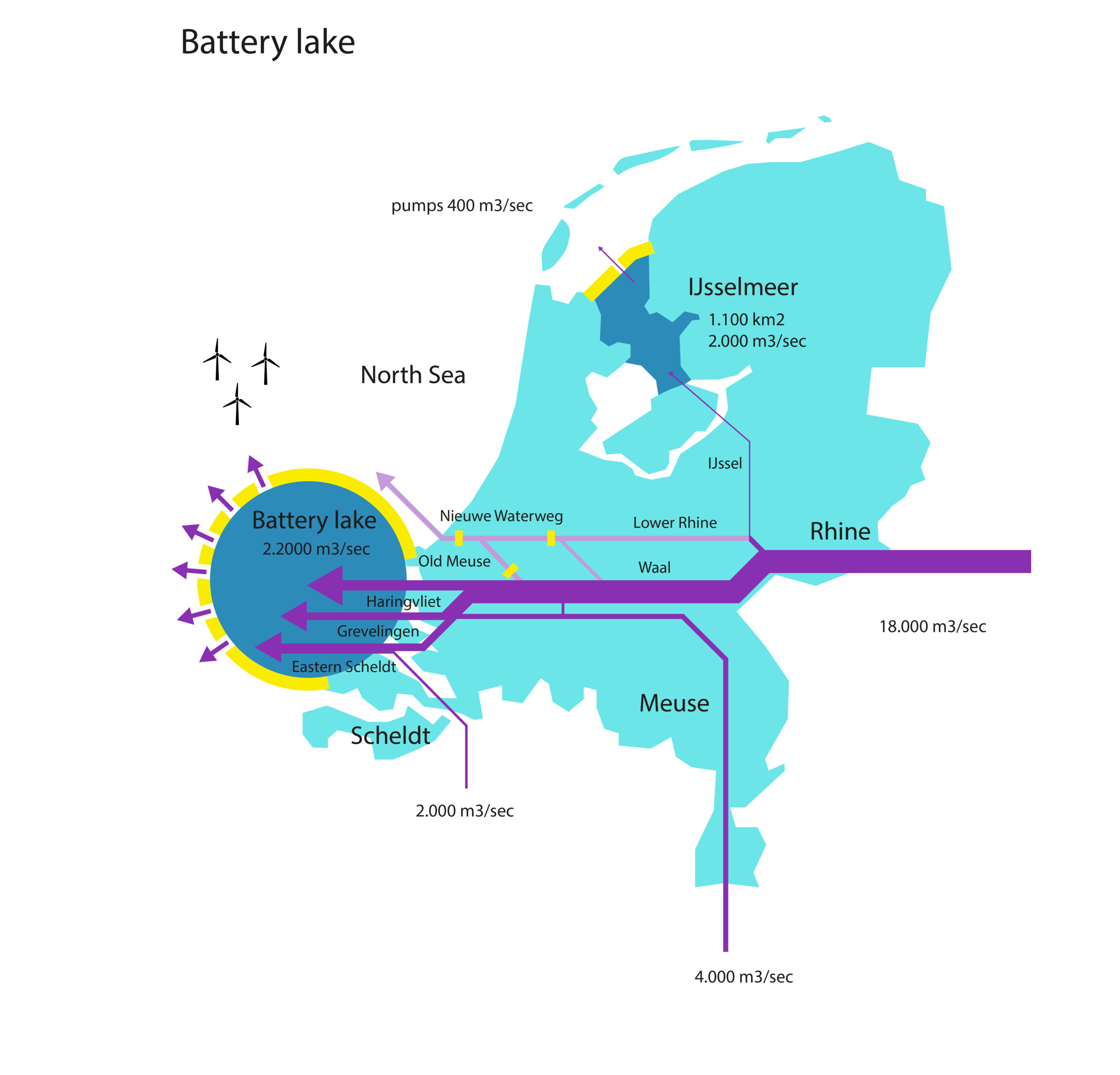
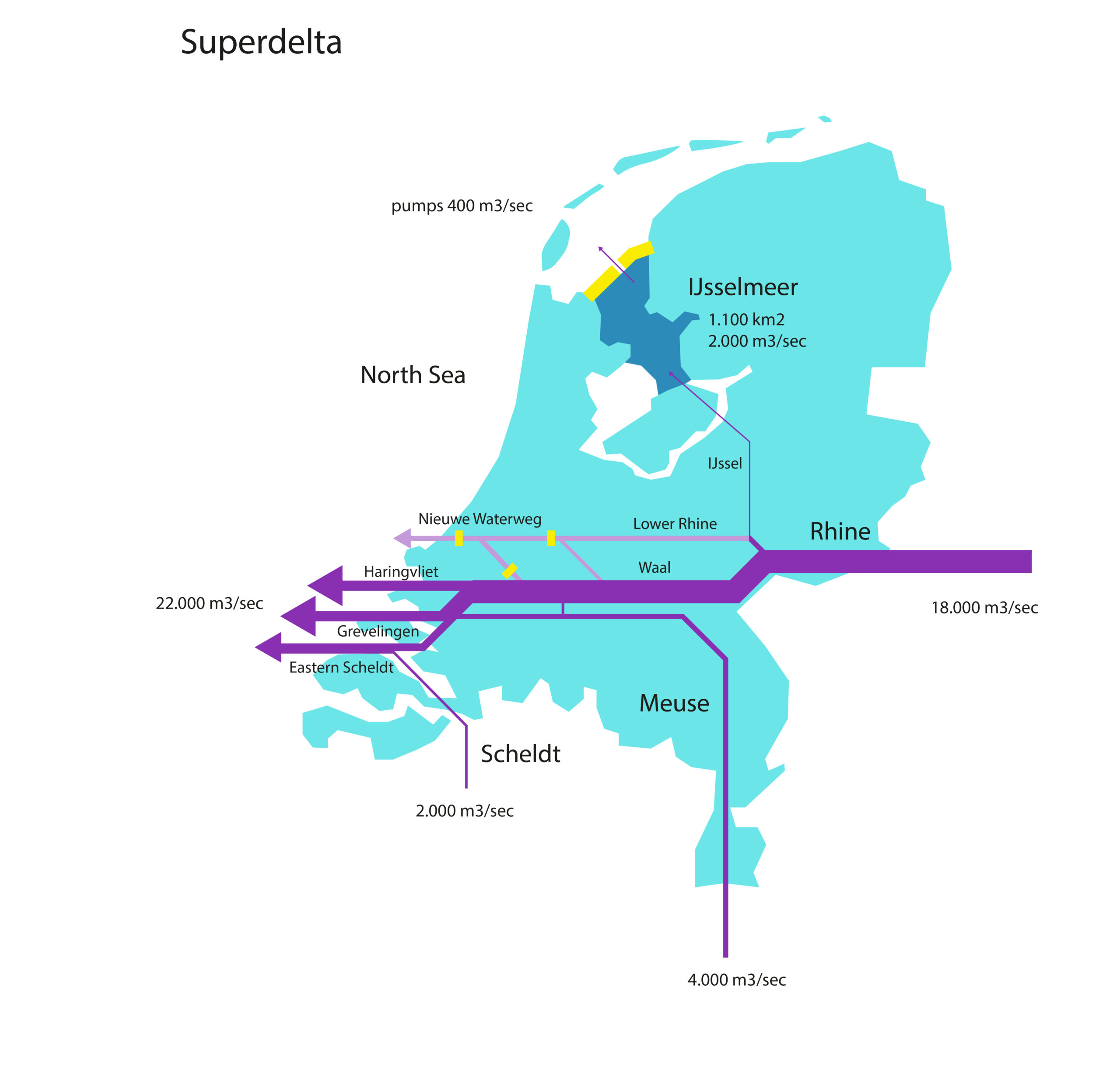
Zeelandia is taking advantage of sea level rise to investigate the spatial possibilities of the Southwest Delta. Where most of the river discharge still runs via Rotterdam, it will disappear behind locks in the event of a sharp rise in sea level and 90% of the outflow will go through the southwest delta. The mouth of our river area considered a spatial laboratory.
The Southwest delta for this research is bounded by dike ring 14 (the protective flood barrier around the Randstad) in the north and the 3 meter height line in the south. Within this scope, the delta was explored on the basis of terrain height, distinguishing between higher ground (above 3m +NAP) and soils below current sea level. Three water scenarios have been developed (Seawards, Full Defence and Superdelta) that lead to different forms of land development and each express the future of the delta in their own way. The water is controlling the land use and land development following social developments. Zeelandia is therefore not a design but an exploration. Imagination is not used as a solution, but for a better understanding of complex reality.
Depending on the chosen coastal protection scenario, the land use and scale of interventions in the landscape will vary. In all cases, we foresee an increase in the scale of agriculture, an increase in energy production, housing and recreational opportunities. Zeelandia experiments with a flexible collision between urbanity, nature, agriculture and energy production. The promise of a spatial symbiosis and building a new and proud monumental landscape that unites sea and land.